Opportunity: Have students map “defensive architecture” and “infrastructural discrimination” on campus or in a local city environment.
We are not talking about the defensive structures of yesteryear (large, impenetrable fortresses), defensive architecture now constitutes a major infrastructural investment in major cities (even as bridges crumble and roads decay).
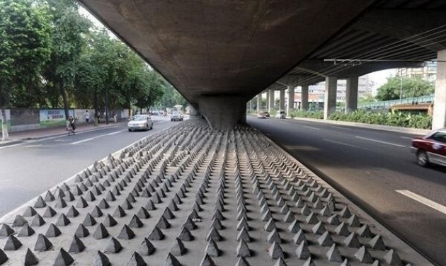
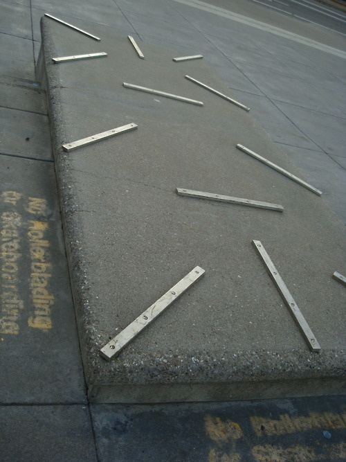
What’s the point? Those spikes are about keeping homeless people from laying down or loitering (above, an imagine from China), although many readers might be more familiar with the anti-skate boarding elements of our urban landscape, like these below (the most supremely dick-ish one I could find):
Here is a broader array of these sorts of defensive architectural moves from around the world. This form of blatant infrastructural exclusion (or infrastructural discrimination, if that makes sense) is surprisingly obvious in everyday life.
No doubt, those of you teaching on college campuses have seen elements like this. A viable assignment, especially if you live in an urban area, might be to map (cartographically) where defensive architecture is in your city.
If you’re not in an urban area, then perhaps less obvious forms of infrastructural discrimination might work, for example, sending students around to determine what school entrances are up to code, for example, related to wheel chair entry or fire code. Surely, this won’t make you popular with the higher-ups, especially if you find the college wanting in some regard; however, it will turn campus into a living laboratory for these sorts of infrastructural investigations. A campus map is usually just as easy to get as a city map, after all.

Wild stuff!
On Fri, Jul 8, 2016 at 10:11 AM, Installing (Social) Order wrote:
>
LikeLiked by 1 person
http://99percentinvisible.org/episode/unpleasant-design-hostile-urban-architecture/
LikeLike
This is an STS research methods class just waiting to happen.
On Sat, Feb 21, 2015 at 11:16 AM, Installing (Social) Order wrote:
>
LikeLike
heh, well when the students interview for the ethnographic portion of the class we can build their take into the mapping.
LikeLike
I’m campus administrators would love maps of campus like these roaming around!
LikeLike
Could not agree more — after mapping, perhaps a follow-up, to extend the lesson further, would be something precisely like that regarding where these offensive people (for whom we obviously need defensive protection from) are “channelled” for “funneled” to. I imagine something like a multi-layered map. One layer lays down the “battlements,” let’s call them. Another later identifies the “routes” away from said battlements and marks open or ghettoized spaces appropriate for such offensives.
LikeLike
this is well done, might only add to have them think about (and maybe map) where the “offensive” people have been displaced to and what actual common/public spaces are left for whom/what-purposes? maybe part of a larger discussion (via @SaskiaSassen types) around expulsions and related extractive-industries/economies.
LikeLike